Shahdad

One of the most historic cities in Iran, dating back to six thousand years ago. Of the wonders of Shahdad, it is enough to mention the first metal flags in the world, city of the dwarves and their kaluts where an alien landscape stretches before our eyes. The term kalut is composed of the terms Lut (the Lut Desert) and Kal (city). Kalut is also known under the name Yardang which means sand castle. In fact, the Kalutos are formations that have been created by the erosion of the wind, forming sand dunes in a thousand different ways.

Saryazd Castle: Old Sasanian Bank

Saryazd Castle is located near the Yazd-Kerman road and in the village of Saryazd, being one of the largest and most beautiful castles in Mehriz county. The castle dates from the Sassanid period, before the arrival of Islam in Iran. This monument is surrounded by a ditch six meters wide and four meters deep. The trench is considered the first layer of defense of the castle.

The castle has two defensive walls and a fence. The outer fence, six meters high, is made up of three round towers and a square tower, and the inner fence, nine meters high, is made up of six round towers. The inner castle, dating from the Sassanid period, was built under a precise order on three floors, including the residential sector, the service sector, etc.

Sareyn

It is a city and capital of the county of Sareyn, 25 kilometers west of Ardebil, and has approximately 8,000 inhabitants, which exceeds 20,000 in summer due to its charming climate. The fame of this city is in debt to its hot springs and its springs are near a dormant volcano on Mount Sabalan. Most of the country’s springs are located in western Azerbaijan, Mazandaran and Ardebil. The water from these springs contains sulfur particles, useful for bone and joint pain. In fact, Iranians have shown great interest in the therapeutic aspect of hot springs.

Sar Agha Seyed

Sar Agha Seyed is located at an altitude of about 2,200 meters above sea level, on Haft Tanan mountain, in the central part of Kuhrang city, about 130 kilometers from Shahr-e Kord, in Chaharmahal province and Bakhtiarí. The town is one of the intact beauties of Iran that must be known to understand the meaning and rhythm of life of the people who still live there. They have been living in the town for years despite the climatic difficulties due to the high altitude and the presence of snow. Sar Agha Seyed is not a place for modern life.

When it snows, the town road is cut off from the rest of the world. Therefore, the beauty and pristine nature of Sar Agha Seyed are completely affected by the seasonal weather. The village was one of the summer resorts of the Bakhtiari nomads. In fact, the Bakhtiari dialect of the Lorí language is spoken here. Sar Agha Seyed is a village with buttress and staircase architecture like Masouleh. Despite retaining its originality, the name of this town is less heard among the peoples of the Iranian highlands.

Rayen Citadel

A splendid adobe citadel dating back to the Sassanid era (4th century AD). This citadel in the heart of the medieval city of Rayen is very similar to Arg-e Bam before the earthquake in 2003, and has all the architectural characteristics of desert castles. It is divided into several neighborhoods: the houses, the bazaar, the food store, the area dedicated to the bourgeoisie and the fortress. The citadel has 15 towers with a single corridor that allowed soldiers to pass from one to another. Rayen’s fortress was inhabited 150 years ago. According to some ancient documents, it was situated on the trade route, and was not only a trading center for valuable goods and high-quality textiles, but also a center for the artisan of swords, knives, and later weapons-making. Rayen is located at 2,200 meters above sea level and offers a picturesque landscape to visitors.

Pasargada

This city, founded in the Pars region in the 6th century BC. C. by Ciro the Great, it was the first capital of the Achaemenids. Pasargadae is the place where a varied mix of art and architecture, adopted from the countries incorporated into the vast Achaemenid empire, was created to generate the unique ancient Persian style, which was later perfected in Persepolis. The archaeological remains of its palaces and the design of the gardens, as well as the mausoleum of Cyrus, are not only an unrivaled example of the first phase of the evolution of Achaemenid art and architecture, but also an exemplary testimony of the Persian civilization. In fact, Pasargada became a prototype of the Persian Garden concept of four quadrants divided by streams and paths. The architecture of Pasargada is characterized by refined details and subtle verticality.

Neyriz

The city of Neyriz is one of the oldest in the province of Fars, with an altitude of 1795 meters above sea level, and is located at a distance of about 230 kilometers east of Shiraz, the name of Neyriz has been mentioned on the Persepolis tablets. Its agricultural products are almond, walnut and pomegranate. Neyriz pomegranate is famous for its special flavor and freshness. In fact, in this city there are more than 10 types of pomegranate that differ from each other by their taste, color and size.

Mesr village

Mesr village is almost a hundred years old and was once known as Chah Deraz. As far as the eye can see, the surroundings are covered with long and short dunes of golden sand. This landscape of particular beauty makes the area famous as a sea of ​​sand. Just stand in one of these dunes for the golden sea to appear before your eyes. The sand dunes sparkle like the shimmering waves of the sea in the sun.

Mesr -means Egypt in Persian- is a desert town located in the central district of Khur, in the province of Isfahan, 45 km from the city of Jandaq and 371 km from Yazd.

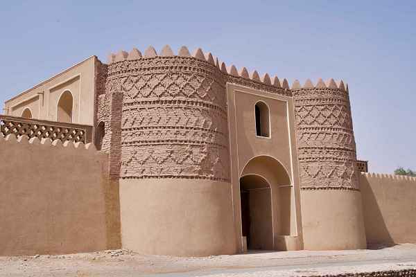
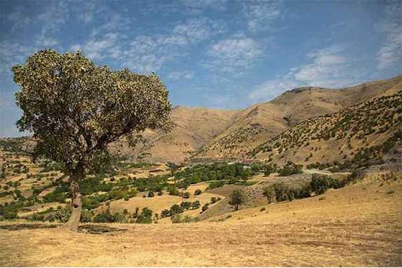
Marivan

The city of Marivan is located 125 km northwest of Sanandaj, near the Iran-Iraq border, at an altitude of 1,320 meters above sea level. The Zagros Mountains are the highest land in Marivan. Being the rainiest city in Kurdistan province, the city’s climate is cold and humid. Marivan consists of three parts, main districts like “Markazi”, “Sarshiv”, “Khavumirabad”, four cities and six rural districts.

Marivan Woods

The forests of the region cover an area of ​​185,000 hectares stretching from the Garan Gorge in the west to the village of Sheikh Attar.

The high western plains of the Zagros Mountains attract moist clouds, thus providing suitable conditions for creating forest cover.
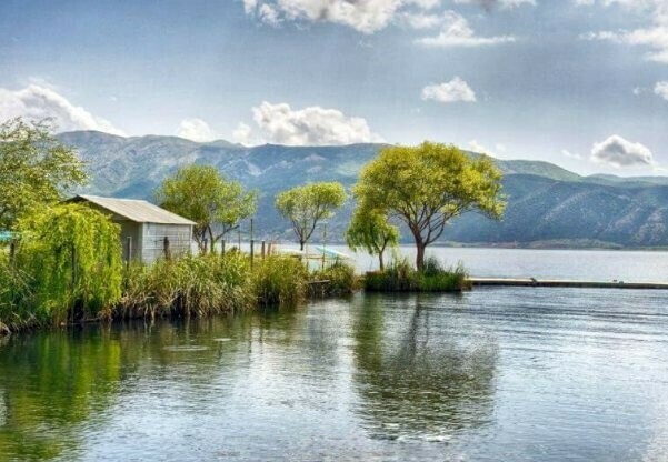
Lake Zaribar

Lake Zaribar is one of the beautiful lagoons in western Iran and is considered a tourist center of the country. This extraordinary ecosystem with an area of ​​about 3,000 hectares, composed of water, reeds and wildlife, is located in the western part of Marivan. This lagoon is home to many species of fish such as common carp, cane carp, and a species of eel. The lagoon is an important aquatic ecosystem in the life cycle due to the seasonal migration of birds and is considered a beauty with great potential for ecotourism.

Maku

Maku is a city in the Iranian province of West Azerbaijan. It is located 22 kilometers from the Turkish border, in a mountain gorge at 1,634 meters of altitude. Zangmar River runs through the city of Maku, the largest free zone in Iran. Maku was the capital of a Kangarli khanate, one of many small semi-independent khanates resulting from the disintegration of the Safavid empire in the 17th century.